The Three Taifas
ZARAGOZA - TERUEL - GUADALAJARA
Road cycling tourism along The Three Taifas route. Travel through the lands of the old petty Kingdoms of Zaragoza, Toledo and Albarracín
- Route: From Calatayud to Cella - Teruel
- Provinces: Guadalajara, Zaragoza, Teruel
- Kilometres: Approx. 309 km.
- Days recommended: 6 days (5 nights)
- Difficulty: medium-low.
Information you can download on this page
- The PDF guide for tourist cycling on roads, including maps, type of road, kilometres and crossings, etc.
- The tracks on the route in GPX, KMZ and TRK format. To always be on the correct track you can download Mapas de España (Maps of Spain) app (only android version available) from the Spanish National Geographic Institute, from where you can access to all of our routes and navigate on accurate maps as well as to obtain additional features for free.
- List of accommodation.
- List of points for obtaining and stamping the Letter of safe conduct.
- List of tourist information offices.
- Tourist brochure (this can be obtained at any of the tourist information offices on the route).Only available in Spanish.
- Guides on (Spanish): castles and countryside of the Way of El Cid as he passed through the province of Zaragoza, published by the Provincial Council of Zaragoza.Only available in Spanish.
Remember that you can obtain more information about each route at the tourist information offices on the Way of El Cid, including brochures and the Letter of safe conduct.
Download our travel app free of charge
We recommend that you download our mobile travel app, available for iOs and Android. With this app you can find all our routes, you’ll never get lost because you’ll always know exactly where you are, and you can view information about 4,500 georeferenced places (sites connected with El Cid, things to see, accommodation, places where you can have your letter of safe conduct stamped, etc.)The app is free, is updated daily and does not require registration. It also works in places without a signal and therefore, when it is being installed and used for the first time, it may take some time to become active, depending on your internet connection. Be patient because it’s worth it!
For more information about the Camino del Cid travel app, click here.  Download our travel app free of charge
Plot: through the lands of the Three Petty Islamic Kingdoms
El Cid fought his first great literary battle (in other words, according to the Poem) in Alcocer, which is today a deserted place near Ateca (Zaragoza) and it is here where travellers start their route, or in Calatayud, 15 km away, to whose gates El Cid chased one of the Moorish generals defeated in his battle with 3000 Moorish knights from Valencia.
The organisation and autonomy of the growing army of El Cid allowed him to travel around the borders of the various Moorish kingdoms without difficulty. Three very different taifas (Toledo, Zaragoza and Albarracín) were used as the literary scenario for El Cid and his people. According to the stanzas of the Poem, victory made it possible for El Cid to impose his law on the various roads and in the many towns of these taifas. Four of the main milestones of the Poem in this section: El Poyo del Cid, in Teruel, where El Cid reinforced a Roman fortress, turning it into his headquarters for Teruel and Zaragoza; Molina de Aragón, in Guadalajara, an area governed by Avengalbón, one of El Cid's Moorish allies, who was to serve him loyally and protect Rodrigo's daughters; Albarracín, in Teruel, a stop-off used by El Cid's followers on their journeys between Castile and the Mediterranean; and Cella, in Teruel, where, according to the Poem, El Cid decided to gather together all the men who wanted to go with him to conquer the city of Valencia.
The journey
You have before you 300 intense kilometres of countryside, history, art and adventure across old, wild lands that once formed part of three Moorish kingdoms or Taifas. A physically demanding route (much of the layout runs through mountains), but fascinating at the same time and with milestones that include four important medieval walled towns: Calatayud, Daroca, Molina de Aragón and Albarracín.
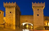
Because of its size and age, Calatayud is one of the most important Islamic walled towns in Spain. The Moorish influence can also be seen in its Mudejar heritage, which includes some of the most beautiful towers this art has produced. In Aragón, it has been declared a World Heritage Site. From Calatayud, we follow the fertile plains of the River Jiloca, which we leave to our right with beautiful landscapes of crop fields and fruit orchards. On the left, a number of very interesting villages start to appear, including Maluenda and Villafeliche, with pretty examples of Mudejar art and silhouettes of castles, today abandoned, that hold very interesting stories from the Middle Ages.
 Mudejar towers of San Andrs and Santa Mara. Calatayud, Zaragoza.
The second important milestone on our route is Daroca, which was once a very important Islamic fortress in the Valley of El Jiloca, one of the stop-off points for ideas, goods and armies from ancient times, since it linked the central plateau of Spain with the Valley of El Ebro and the East. Daroca has an important wealth of artistic heritage (including good examples of the Romanesque style) as a result of the town's rich history. At dusk, the town walls take on an interesting golden colour.
The backbone of this route, up to Monreal del Campo, is the National 234 road, which we will alternate with minor roads, such as the one that runs from the mountain pass of Villafeliche to Daroca, passing through a unique geological area. Cycling along the N-234 road is not an overwhelming experience since there are no steep slopes and traffic is not too busy. The journey is also interrupted by small villages set along the route and, overall, as there are no difficult gradients, these first 100 or so kilometres make for easy cycling.
In Monreal del Campo, the route heads for Molina de Aragón. The old medieval track is hidden under the National 211 road, which we will follow until we reach Molina, 50 km further on along a generous hard shoulder. Molina de Aragón is the third town on the route, laden with monuments, with its castle as its symbol (perhaps the most beautiful of those on the Way of El Cid).
 Castle of Molina de Aragn, Guadalajara.
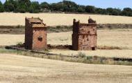
From Molina, the landscape changes brusquely and we travel into one of the most untouched areas of the entire route, cycling along 150 km of local and regional roads on small sections with steep ups and downs that will put your fitness to the test and where you are more likely to come across as many roe deer as cars. On our way to Albarracín, we will cross the Gorge of La Hoz and five natural areas: the Natural Reserve of the Upper Tagus, the Mountains of Picaza, the Bogs of Orihuela, the Juniper Forest of Monterde de Albarracín and the Pine Groves of Ródeno: river gorges and canyons, birds of prey, mixed forests of ilex, juniper and black pine (especially the latter), bogs, mountain goats and all kinds of deer. The entire area is also an impressive outdoor geological museum with all kinds of faults, folds, stone rivers, drop stones and all forms of erosion, some of which are particularly interesting, such as the Towers of Chequilla. After crossing this countryside, we arrive at Albarracín, one of the most beautiful villages in Spain.
 Santuario Virgen de la Hoz, Guadalajara
Albarracín is the fourth largest walled town on this route and was the capital of the small but important Taifa of the Banu Razin. Here, according to history, El Cid was almost killed in a brawl. From Albarracín, after a well-deserved rest, we head for Cella. On this last section of the journey, we can visit one of the most important hydraulic works of Roman times in the area, conserved by the Arabs: the aqueduct that joins together Albarracín and Cella, part of which is dug into the rocks and which travellers can follow along some of the sections.
 Albarracn, Teruel / ALC
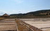
One last surprise awaits in Cella, the end of the Three Taifas section: its artisan well, one of the largest in Europe. In the 12th century, Cella was probably a border town and very 'lively', with a good number of mercenaries. It was the place chosen by the author of the Poem as the place where El Cid waited for all those who wanted to go with him on his conquest of Valencia. Many travellers usually extend the journey and continue on to Teruel, which, in the 11th century, was more of a communications centre than a village.
Culinary delights
Gastronomy in these areas has one common denominator, especially in the mountains: heavy stews and game, ranging from stewed beans with game to pickled partridges, including vegetable stews. However, the unquestionable king of the table is ternasco (young lamb), which shares its throne with stewed kid goat in Molina de Aragón. Don't leave Calatayud without trying its wonderful chickpeas with conger eel or fardeles and don't leave the province of Teruel without trying its famous ham, with Calamocha as the most important place in the local "ham world". Fish dishes include traditional cod and trout. Besides the delicious peaches in wine, all along the route you will find different deserts of Mudejar origin, gastronomic evidence of its Islamic past: Daroca is famous for this type of confectionery and you can try the Mudejar trenzas or almojábanas, the most famous of which are to be found in Albarracín, which is also well known for its excellent cheeses.
Singular roads
The term ‘Singular Road' on the Way of El Cid is used for the sections of road that are of particular importance for cycling tourists or because of the countryside, history or artistic heritage. This route has the following Singular Roads:
Road between Villafeliche and Murero (4 km). Zaragoza
4 km from Villafeliche, on the way to Daroca along the N-234 road, you will come across a turnoff to the right that takes you to Murero along one of the most singular roads of the Way of El Cid. Downhill and crossing through a pine grove, we come to an unusual outdoor museum: the Gorge of Valdemiedes, an archaeological site from the Cambrian period (around 500 million years ago) whose fossilised 'tattoos' in the stone show the lifeforms that existed during said geological period. No traffic.
GU-958 road between Ventosa and Torete (10 km). Guadalajara
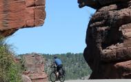
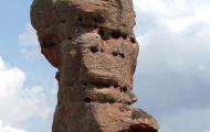
This simple provincial road runs next to the River Gallo through peaceful countryside in the heart of the Natural Reserve of the Upper Tagus. It is a very pleasant route for cycling tourists, setting off from Molina de Aragón. Although it is narrow and has patches on the surface, it has hardly any traffic mid week and is flat with a slight downhill. On the route, travellers can stop off at the Gothic-Renaissance Church of La Virgen de La Hoz, guarded by high, interesting crags that stand as the result of erosion, which sometimes creates strange 'hallucinations' in stone.
• A-1512 between Orihuela del Tremedal and Bronchales (15 km). Teruel
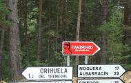
This road runs through the natural area of the Bogs of Orihuela. It sets off from Orihuela del Tremedal on the way to Griegos and Noguera de Albarracín, later veering off towards Bronchales along a tarmacked road. It is a continuous steep slope through a dense forest of pines and Pyrenean oaks where you can see bogs and the famous stone rivers. The road is highly enjoyable, with little traffic and very attractive for cycling tourists, even though the continuous uphill will make more than a few work up a sweat.
 Road to Bezas-Gea from Albarracn, for cyclotourits / ALC.
Signposting
The roads are signposted at crossings and strategic places. For greater convenience, we recommend you take the cycling tourist route guides and the track.
The route runs mainly along pleasant roads, some of which are very unique, for cycling tourists. Although the two sections run along the N-234 and N-211 roads, they have a hard shoulder and are not particularly difficult. Indeed, the minor roads with no traffic you will travel along are the ones where you need to take great care, since it is easy to be too confident and, on the downhill sections for example, take bends wider than is recommendable.
Tips and recommendations
Length of the stages: it is best for each one to decide their own stages according to their strengths and personal preferences. Some people place the emphasis on doing exercise, others on the cultural side of the route and others on the simple pleasure of taking in the countryside and locations. The stages we suggest are a combination of all three and have been designed for average tourists cycling under stable weather conditions to enjoy the route without too much stress.
Travel safely and unhurriedly: take the tracks and route guide with you.
Food and spares. One of the main advantages of the Way of El Cid is that it runs through very attractive places with few inhabitants: many of the villages are very small and they do not have food stores. Unless you have planned to eat in a bar or restaurant, it is very important to take some food with you (sandwiches, nuts, energy bars, etc.) in case you can't find anywhere to eat or buy food. Also remember to take water with you. In most of the villages, there are drinking fountains: remember to refill your water bottles before setting off again. The same applies for spare parts: remember to take a repair kit with you and the more complete it is, the greater your peace of mind will be. Welcome to the Middle Ages.
Book your accommodation in advance. You are about to travel through one of the areas with the lowest population density in Europe. Some villages are very small and have limited infrastructures. Book your accommodation at the end of the stage in advance and if you change where you plan to finish the route, check that there is accommodation available there.
Check our cartographic viewer: the Alerts on Route shows you the most important incidents you can find on the way: tall vegetation, interrupted steps, road works, fallen or missing signs and any other obstacle from which you need to be warned about.
Don't forget your helmet: it is compulsory for adults to wear helmets on roads outside cities and for under 16s it is compulsory at all times.
Get your Letter of safe conduct. The Letter of Safe Conduct is a personalised 'passport' you can have stamped at many towns and villages on the Way of El Cid. You can use it to get discounts of at least 10% in more than 200 places of accommodation and benefit from special offers. It is free and you can apply for it at any of the more than 70 tourist information offices on the route or at the Way of El Cid Consortium.
Your literary guide. You might think it's unnecessary weight, but for many it is essential: don't forget to take with you a copy of the Poem of The Cid; you will be able to recreate some of its passages on site. If your Old Spanish is not so good, take a modern version!
How to get there… and get back
Normally, you will start the route in Calatayud, an important communications centre 8 km from Ateca. The Provincial Council of Zaragoza has set up a hiking route between both towns. For more information about the transport options in Calatayud, click on the information about the municipality. You can also start from Ateca, 9 km away: for more information on how to do that, click on the information about the municipality.
For more information about the transport options in Cella, click on the information about the municipality. Some travellers extend their journey one stage further and continue until they reach Teruel, 27 km away and an important communications centre. For more information about the transport options in Teruel, click on the information about the municipality.
Rev. ALC: 09.02.2021


